3.1. Map management
The functions of Selenge River basin map management includes: add, delete, import, export, search, classify, refresh. The map information includes map ID, title, creation time, update time, and map classification name. Click the selected map to perform the required operation, Fig. 3.1 is shown.
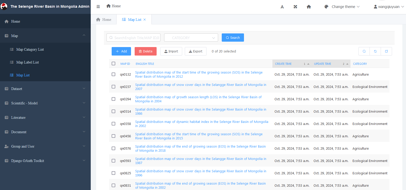
Fig. 3.1 Map management
3.1.1. Map classification management
Add classification to map
Click “Add function” to add the category, you can select the superior name, category name, classification sort. After the category is selected, you can perform editing, adding, deleting, viewing operations. As shown in Fig. 3.2 .
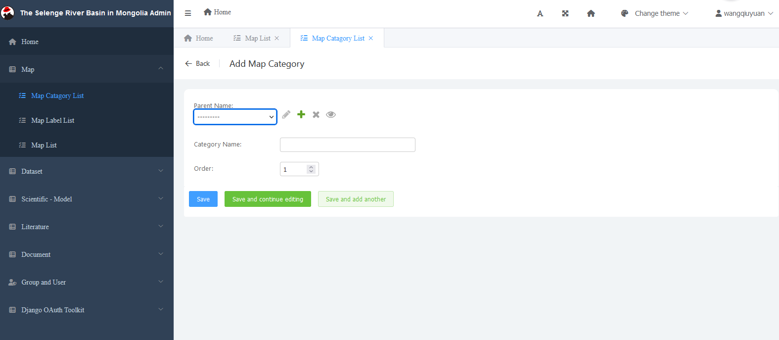
Fig. 3.2 Edit classification
Map modification classification
According to the requirements, select a category, and then select the submenu information , as shown in Fig. 3.4 .
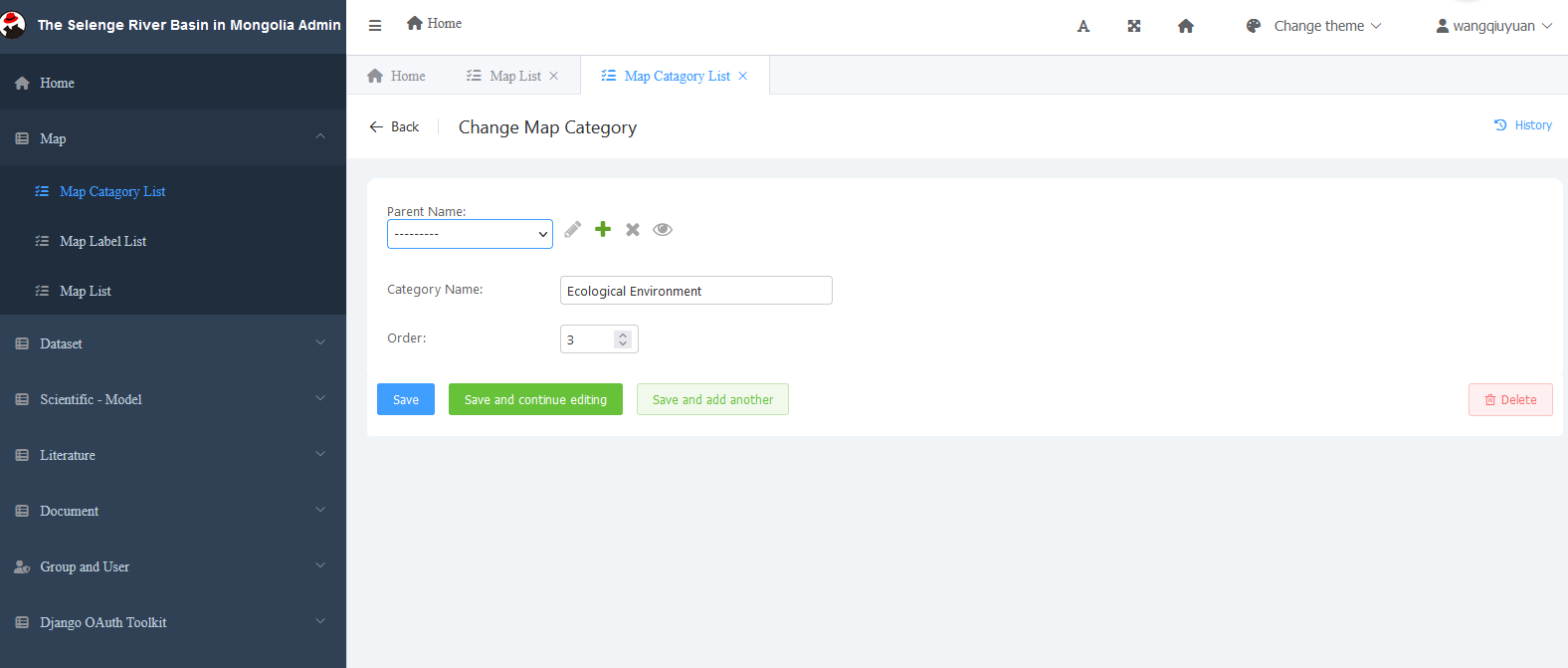
Fig. 3.3 Modify the classification
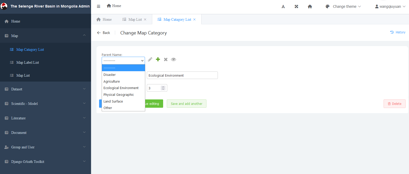
Fig. 3.4 Selection category
Map classification import and export function
After clicking the “Import“ button in the classification of Selenge River map, you can then find the file you want to import and submit it.The “Export“ function can select the fields and formats to be exported and select submit for export. Fig. 3.5 is shown.
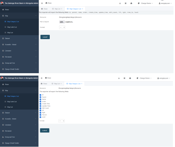
Fig. 3.5 Map classification import and export
3.1.2. Label management
There include “Add, delete, import, export, refresh“ functions in the label management of Selenge River basin map. As Fig. 3.6 shows.
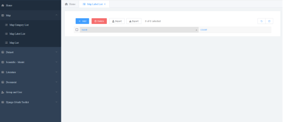
Fig. 3.6 Label management
Click the “Add” button to add the map label. After adding, there are three operations: save directly, save and continue editing, save and add the next one. As shown in Fig. 3.7 .You can delete, import, export, and refresh it by clicking the corresponding buttons.
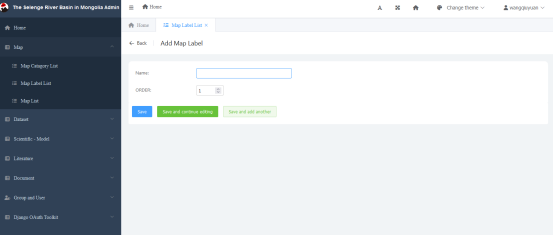
Fig. 3.7 Add functionality
3.1.3. Map data list management
Map add and delete function
The map data publishing program is used to publish the map information in the precision regulation method of animal husbandry in the Selenge River basin of Mongolia and the network collaborative platform. According to the definition of the database, add operations in the background of map data management. In the data map editing interface of QGIS map. Click the Selenge River basin data and select all the edited data for editing. Fig. 3.8 is shown.
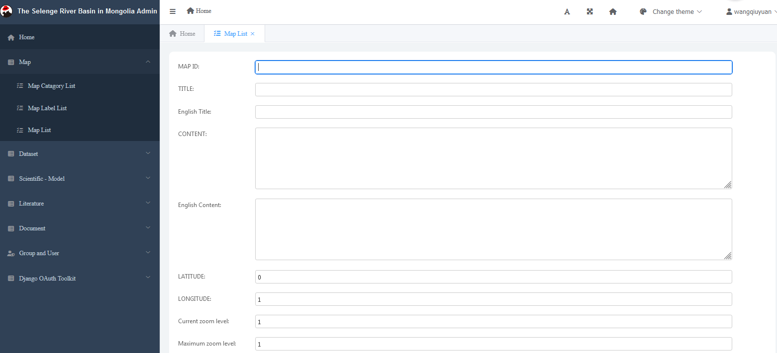
Fig. 3.8 Edit data
When editing users enter information, they enter it item by item according to the fields designed in the database, including:
The title. Title is the theme of the map data.
Title English title, English theme of map data
ID map, the encoding of the map data, used for program extraction.
Category classification, which displays all data categories at the station.
Latitude and Longitude, which displays the longitude and latitude of the map data.
Content body content, the detailed content of the map, entered based on Markdown syntax.
Map import and export function
In map management, first select the Selenge River basin project and then click “Import“, you can directly click to findthe file to be imported and submit it. The “Export“ function can select the fields and formats to be exported and select submit for export, as shown in Fig. 3.9 .
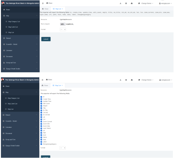
Fig. 3.9 Import and export of map data
Map search function
There are search and refresh functions in the data information, which can be searched by map ID, title or by selecting map classification. There is refresh function in the upper right corner of the interface, and you can click to refresh. Fig. 3.10 is shown.
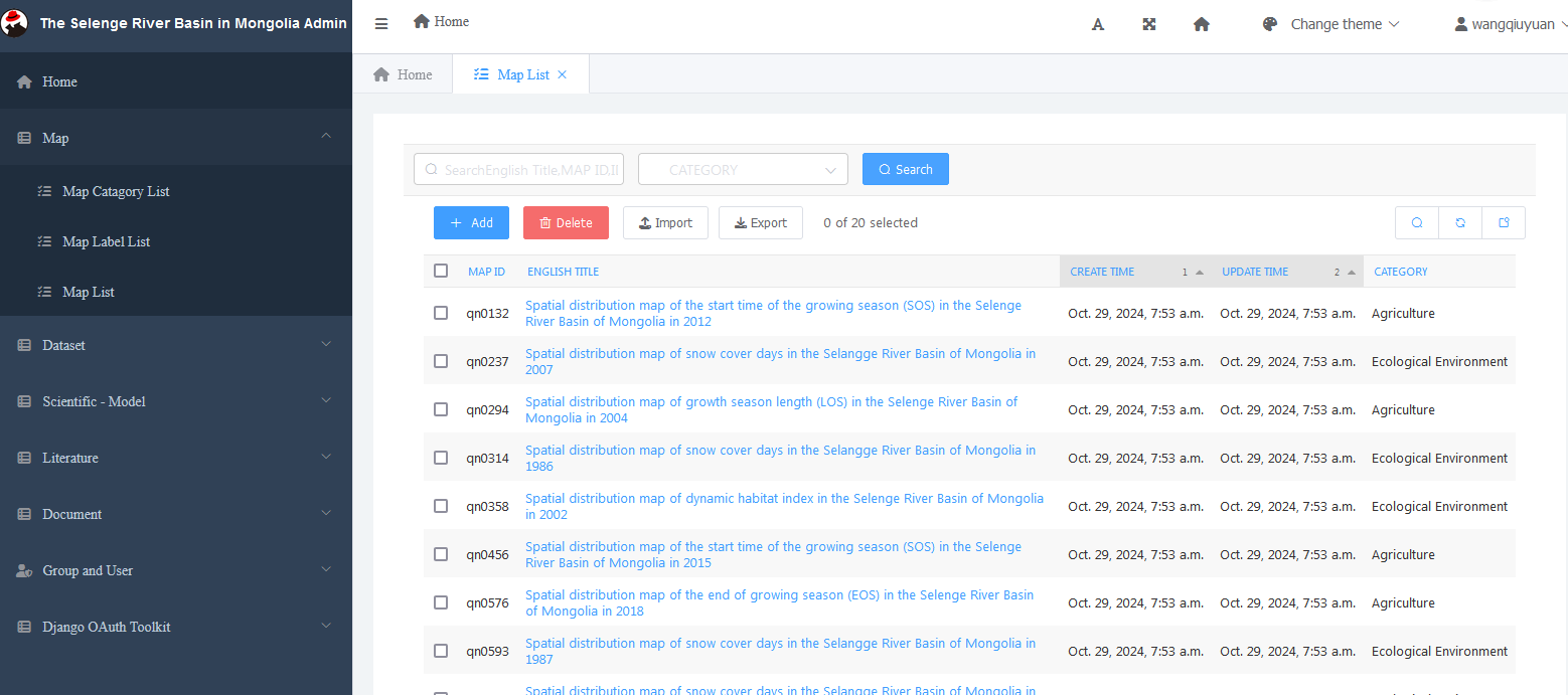
Fig. 3.10 Map search
Modify map information
When modifying user input information, as shown in Fig. 3.11 , input item by item according to the database design fields, including:
Map ID
Title
English title
Profile
Introduction in English
Latitude and longitude
Initial zoom level
Maximum zoom level
Map name
Map name
Address
Path
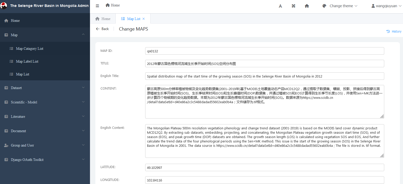
Fig. 3.11 Modify map data